
-
Home
- About Upazila
-
Upazila Parishod
Upazila Standing Committee meeting
-
উপজেলা স্থায়ী কমিটির সভা
-
Standing Committee on Health and Welfare
-
Social welfare committee meeting
-
Meeting of Upazila Committee on Secondary and Madrasa Affairs
-
Standing Committee on Freedom Fighters
-
Women and Child Development
-
Committee on Communications and Physical Infrastructure
-
Environment and Forest Development
-
Meeting of Standing Committee on Primary and Mass Education
-
Rural Development and Cooperative Committee
-
Upazila Agriculture and Sich Committee meeting
-
Law and order committee
-
Youth and Sports
-
Committee on Public Health, Sanitation and Clean Water Supply
-
Market price observation, monitoring and regulation
-
Committee on Fisheries and Livestock
-
Cultural committee meeting
-
Finance budgeting, planning and local resource mobilization
-
উপজেলা স্থায়ী কমিটির সভা
-
Upazila Administration
- Municipality
- Govt. Offices
- e-Services
- Gallery
-
Home
-
About Upazila
Introduce to Upazila
History & Tradition
Geography and Economics
-
Upazila Parishod
Upazila Parishad
Minutes
Annual Development Plan (AP)
Development Plan
Citizen Charter
Information Officer
Upazila Standing Committee meeting
- উপজেলা স্থায়ী কমিটির সভা
- Standing Committee on Health and Welfare
- Social welfare committee meeting
- Meeting of Upazila Committee on Secondary and Madrasa Affairs
- Standing Committee on Freedom Fighters
- Women and Child Development
- Committee on Communications and Physical Infrastructure
- Environment and Forest Development
- Meeting of Standing Committee on Primary and Mass Education
- Rural Development and Cooperative Committee
- Upazila Agriculture and Sich Committee meeting
- Law and order committee
- Youth and Sports
- Committee on Public Health, Sanitation and Clean Water Supply
- Market price observation, monitoring and regulation
- Committee on Fisheries and Livestock
- Cultural committee meeting
- Finance budgeting, planning and local resource mobilization
Annual Financial Statements
-
Upazila Administration
Upazilla Nirbahi Officer
About Organogram
Schedule Meeting
Services & Others
- Municipality
-
Govt. Offices
Security & Discipline
Agriculture, Fisheries, Livestock and food
Health and Environment Related
Engineering and ICT
Human Resources
Land and Revenue Related
- e-Services
-
Gallery
Photogallery
Video Gallery
Dinajpur Sadar Upazila is bounded on the north by Kaharol and Khansama, on the east by Chirirbandar, on the west by Biral Upazila and on the south by Kumarganj and Gangarampur Thanas of West Dinajpur District in the Indian state of West Bengal. India Border Bangladesh - Sundara, Khanpur, Dainur, Baragram, Manipur and East Mohanpur BOP Camp.
1. Geographical Location: 25030 to 25045 longitude and 6035 to 8048 latitude.
2. Area: Square Mile: 137.61, Sq. Kilo: 354.83, Acre: 6,558, Hectare: 35,446. Size: 354.63
B: What: Number of people: 4,64,598 Men 2,46,692 Female 2,37,605 Population growth rate: 1.31 Ethnic populations include: 6,465
Number of municipalities: 01
City Corporation: 00
Number of unions: 10
Number of villages: Number of mouzas: 218
Police station 01
Hat-bazaar 6
River:
Number of households: 1,11,69 Density of population per sq. Km 138 people
Number of farming families: 34526
Number of landless farming families: 33455
Small farming family 5638
Marginal peasant family 1438
Medium farming family 5633
Large farming family 1582
Food demand 90925 May: Tons Total food grain production: 150009 May: Tons Surplus food: 59064 May: Ton Agricultural grains and fruits Main agricultural grains Paddy, jute, wheat, maize, potato, mustard. The main fruit Litchi, mango. Forest Total forest area Reserve forest Vested forest Acquired forest Khas forest 52 acres
Nursery: Government Nursery: 01/02 Private Nursery 30 Upazila Nursery: 01
Education related: Medical College: 01 University of Science and Technology: 01 Polytechnic Institute: 01 Textile Institute: 01 College of Law: 01 Commercial Institute: 01 Government College: 03 Private College: 12 Madrasah 35 PTI: 01 Government schools: 02 Private schools: 63 Government Primary School: 118 Registered private primary school 59 Unreji: Private Primary School: 03 VTI: BKSP: 01 Government Veterinary College 01 Homoeo College: 01 B. Ed College: 01 Vocational Training Institute: 02 Youth Training Center: 01
Communication system Paved road 222.64 km Half paved road 10 km Raw road 617.8 km Rail: 08 km Railway station: 01
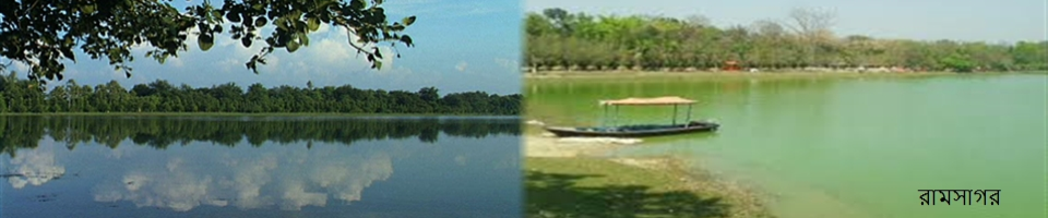
Crop lands: Cultivated land: ০1032 acres Land under net crop ০1032 acres One crop land 645 acres Land under two crops 20254 acres Land under three crops 48063 acres More than three crop lands 4800 acres Total arable land: 19395 acres Crop concentration rate: 263% Production targets: 6264 May: Tons Plantation of transplanted aman 62981 acres A) Ufshi- 45852 acres B) Local- 1809 acres Acquisition of cultivation: 603 Amount of cultivable fallow land: 30 acres Land information: Amount of land in municipal area 5203 acres Landless 5020 acres Marginal farmer 2975 acres Medium farmer 22900 acres Big farmer 13236 acres Arable land per capita 1.09 acres Union Land Office 10 Upazila Land Office 01 Religious Institutions and Population: Mosque: 630 Temple: 90 Churches 05 Pagoda 06 Muslim: 396,155 people Hindu: 6017 people Christian: 5392 people Buddhist: 61 people Others 2961 people Profession: Agriculture Agricultural workers Workers: Business: Transport workers: 18,000 people Job: 1098 (official) Industry and minerals Thermal Power Station: Solid rock project: Coal Mining Project Locomotive factory Sugar mill Textile Mills: 01 closed Automatic rice mill 118 Semi-automatic rice mill 04 Chatal rice mill 316 Major Rice Call - Automatic Flower Mill: 22 Cold storage 04 Jute mill - Lozenge Factory: - Garments: - Mixed factory: 01 Poultry hatchery Health related: Total Upazila Health Complex 01 Total Union Health Sub-center 09 Total private clinics: 20 Ports and others Land port: - Cotton Development Board: 01 Bank: 55 (public and private) Number of NGOs: 42 Accommodation 3 Shelter 4 Adarshgram: 2 Inter-upazila ferry 1 Constituency: ৮- Dinajpur-3 Total number of voters: 293199 people Men 146350 people Female 14749 people Main export products Places of interest


Planning and Implementation: Cabinet Division, A2I, BCC, DoICT and BASIS
Technical Assistance:
![]()
Developed By:
